The National Weather Service (NOAA) has issued a continued hazardous weather outlook for the next week, but storms are headed our way today.
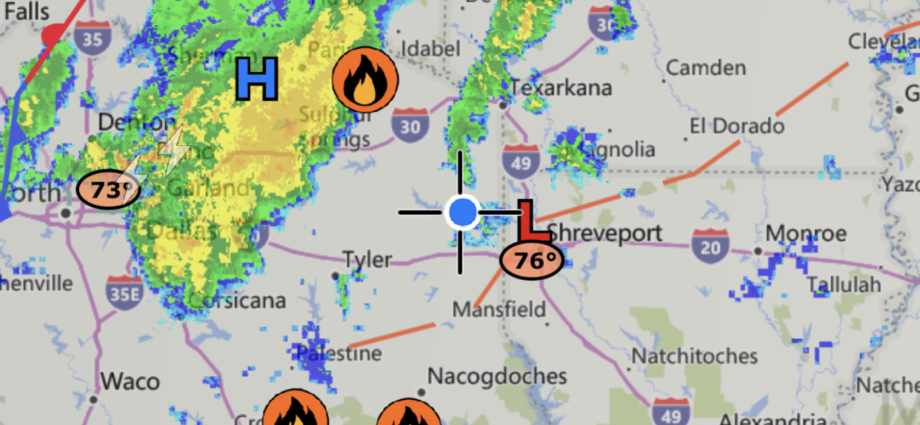
Radar images indicate a storm should roll into Marion County in the next couple of hours Sunday morning.


The NOAA hazardous weather statement:
This Hazardous Weather Outlook is for portions of south central
Arkansas, southwest Arkansas, north central Louisiana, northwest
Louisiana, east Texas and northeast Texas.

.DAY ONE...Today and Tonight...

A heat advisory has once again been issued for these portions of
the Four-States region today, as heat index values will be well
above 100 degrees into the evening hours. Isolated showers and
thunderstorms will also be possible in the afternoon, fueled by
peak afternoon heating.

.DAYS TWO THROUGH SEVEN...Monday through Saturday...

The heat will continue into at least the first part of next week.
Depending on storm coverage Sunday into Monday, the Heat Advisory
may need to be extended into early next week. Otherwise,
thunderstorms will continue to be in the forecast through at least
the middle portion of this week.
Discover more from Marion County Herald & Jefferson Jimplecute
Subscribe to get the latest posts sent to your email.